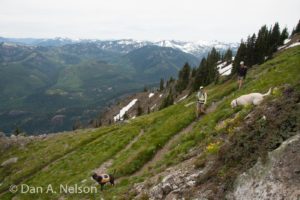
While hikers usually opt for the longer and less steep trail starting near the Issaquah High School, paraglider pilots and hikers seeking a more strenuous workout climb this trail from the small King County Park off Issaquah-Hobart Road to the two launch points atop Poo Poo Point. The south-facing launch looks out over the Enumclaw Plateau to Mount Rainier, while north launch offers views to the north and west to the Bellevue area.
- Distance: 4 miles, round-trip (out-and-back)
- Elevation:
- High point – 1,850 feet
- Elevation change – 1,600 feet
- Best Season: February-May
Before leaving the parking lot, check the sky to the north and south to make sure there are no aircraft (hang gliders or paragliders) trying to set down in the field. These glides lack motors, so once they commit to landing, they will land. If there are pilots approaching the ground, wait for them to land before crossing the field. The trail enters the forest opposite the parking lot and soon turns south and starts to climb the steep flank of Tiger Mountain.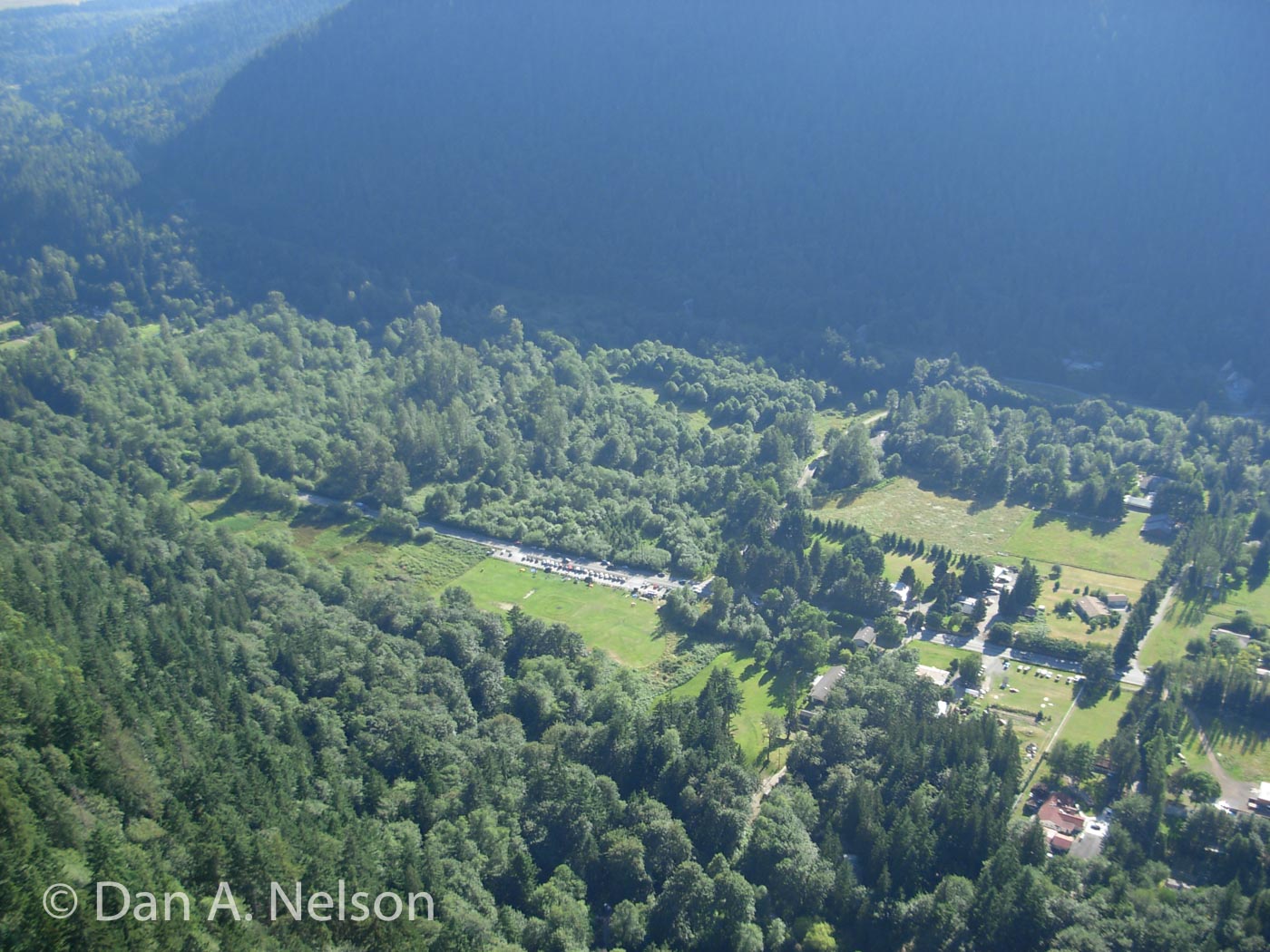
The Washington Trails Association has rebuilt this previously rough-hewn trail, installing rock steps and curbs to make the climb safer and easier. You’ll climb steadily for the next mile, switching back periodically as the path ascends through a thick second-growth forest.
 At about 1 mile, the climb moderates and the trail drops onto an old logging road track briefly. The “road” is more a wide trail these days, and in less than a tenth of a mile, you’ll leave it and start climbing once more. From here the trail is more open, with more chance to see the varied growth along this southern flank of the Poo Poo ridge.
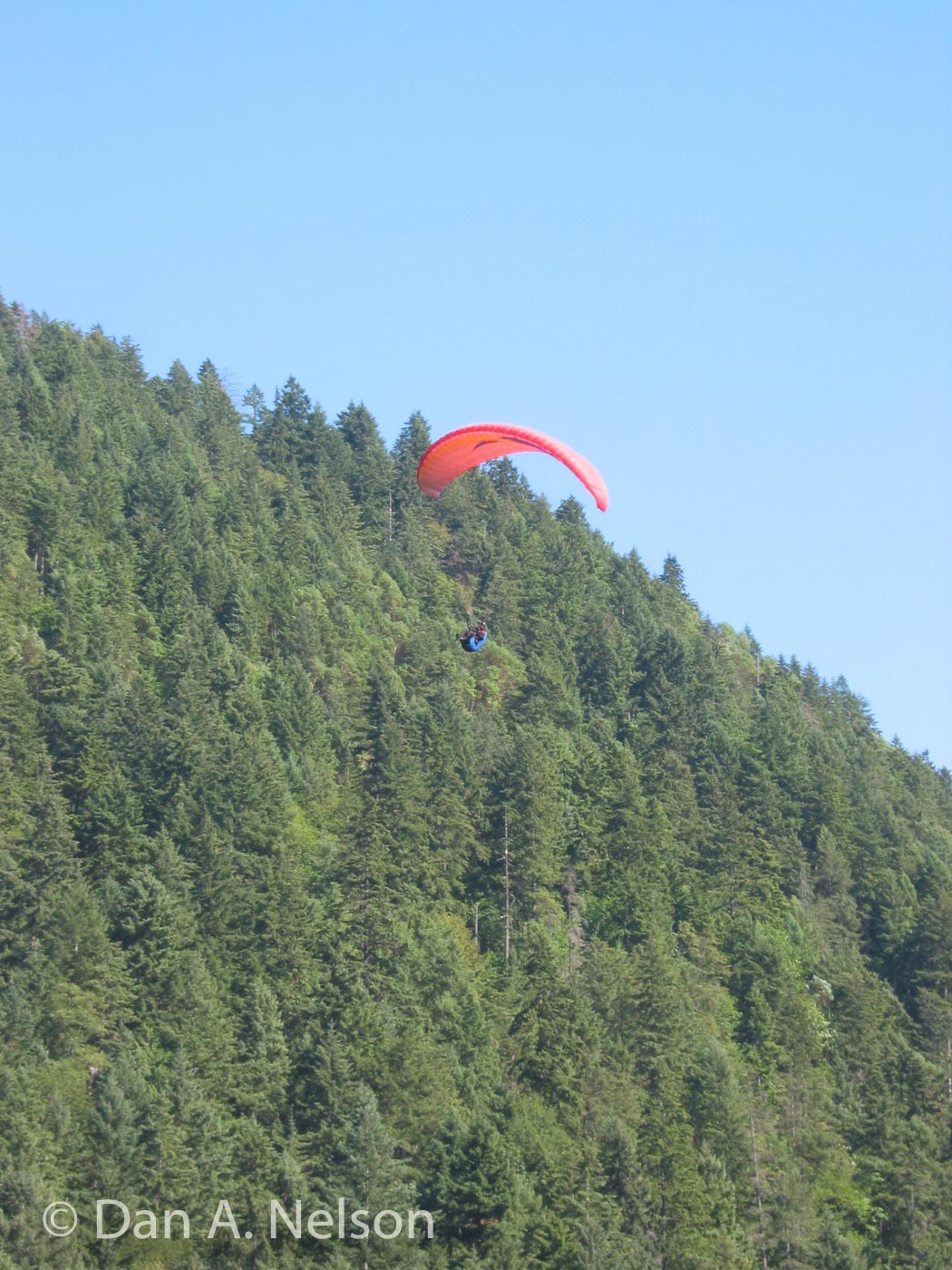
At about 1.7 miles, a switchback to the left skirts a patch of sunshine at the base of a long, steep open slope. This is the bottom of the clear-cut slope that serves as the southern launch for hang gliders and paragliders. Step out onto the small side trail at the apex of the switchback and look skyward. If the winds are blowing out of the south, you might see gliders launching above you.
Continuing up the trail, you’ll switchback several times, and might occasionally miss the main trail since the next quarter mile features heavily braided trail—trail runners seeking the most direct route down have cut several “shortcuts” through the trees. Your best bet, however, at any intersection is to stay on the trail that climbs the most gradually.
At about 1.9 miles, the trail bursts into a grassy clearing. This is the top of the south launch. Pause here to enjoy the views to the south. On clear days, Mount Rainier looms large far beyond the expanse of the Enumclaw/Black Diamond Plateau.
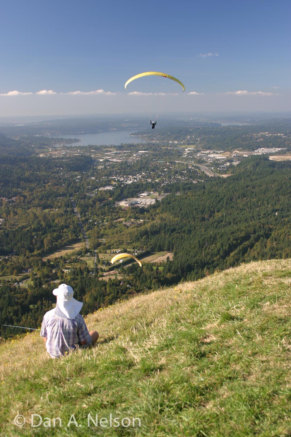
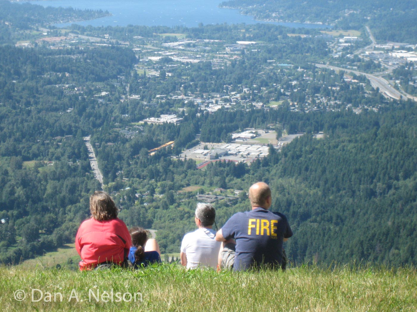 The trail crosses the grassy clearing and reenters the forest just north of a small road spur. A short tenth of a mile brings you through a somewhat marshy stand of forest to the north launch. Hang gliders and paragliders launch off this sloping lawn most afternoons spring through early autumn. Nonpilots can rest on the grassy hillside above the launch area, enjoying views of Issaquah Valley, Lake Sammamish, and the Bellevue skyline beyond. The large panels of AstroTurf were installed by the paragliders to help them keep their lines weed-free during the launch cycles. Note that the AstroTurf was recycled and repurposed from the football field of the old Kingdome football stadium in Seattle.
Map Data: Pilots Trail (.kml & .gpx track logs)
GETTING THERE
From I-90 take exit 17 (Front Street) and turn right (south). Continue southeast along Front Street as it leaves town, and about 2.8 miles from the I-90 interchange turn left into a gravel parking lot alongside a long grassy field. The trail starts in the middle of the field, opposite the parking lot. Note: Due to the nature of air currents, most paraglider pilots fly mid- to late afternoon from May through October. During those months the parking is full to overflowing by noon, lasting into the evening every weekend day (except when raining). Hit this trail early to avoid the full lot and crowded trail.
[ngg src=”galleries” ids=”5″ display=”pro_horizontal_filmstrip”]